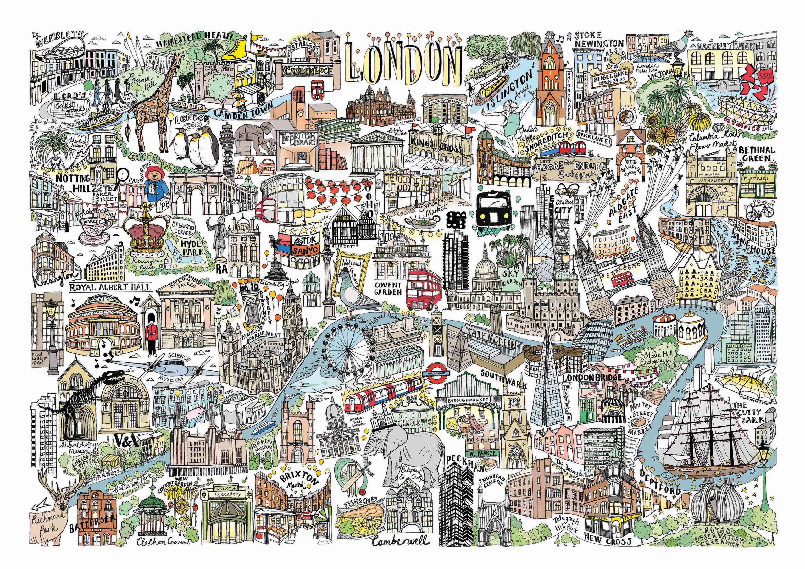
 Katherine KannonPersonal project – Illustrated map of London View Folio
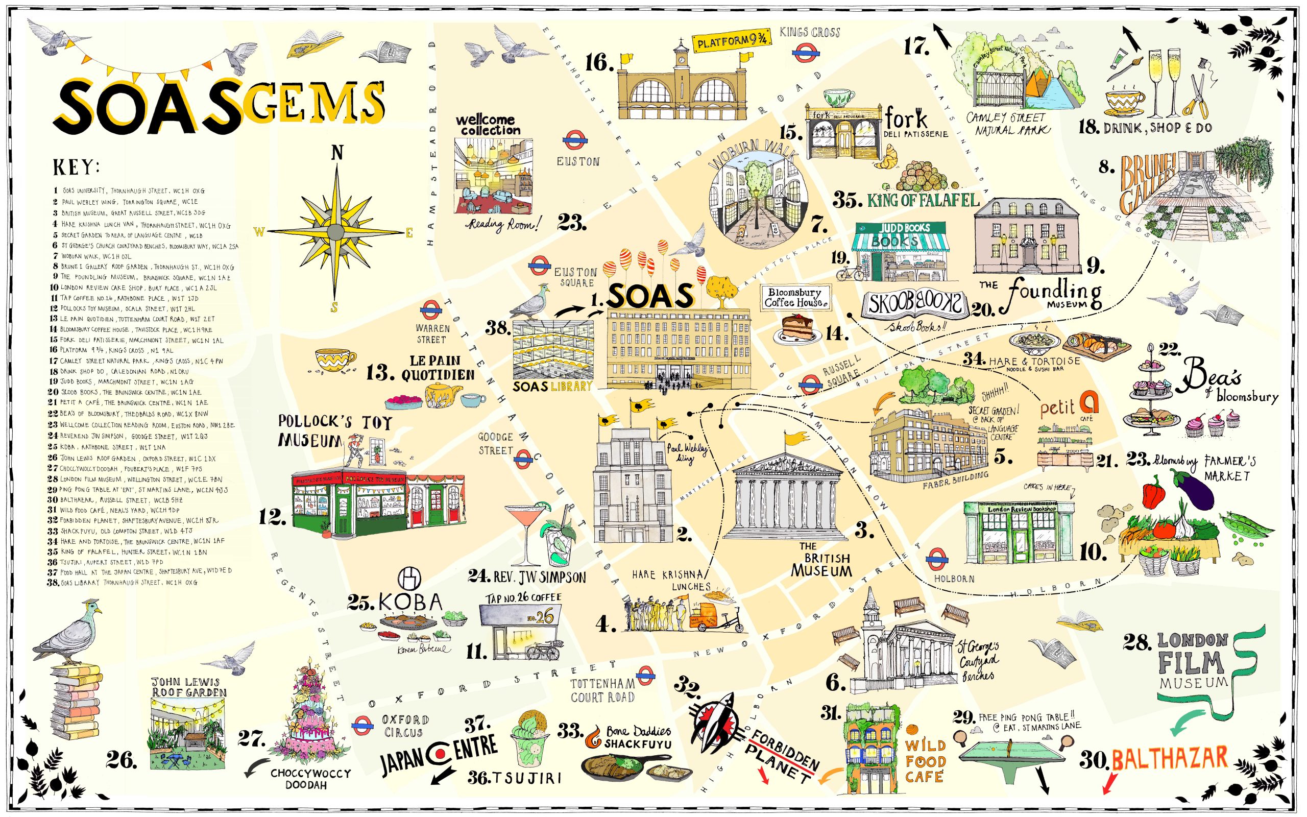 Katherine KannonSOAS illustrated Bloomsbury mapThis map of Bloomsbury was commissioned by SOS, University of London and features the favourite cafes/restaurants and hangout spots around their Bloomsbury campus as voted for by students. View Folio
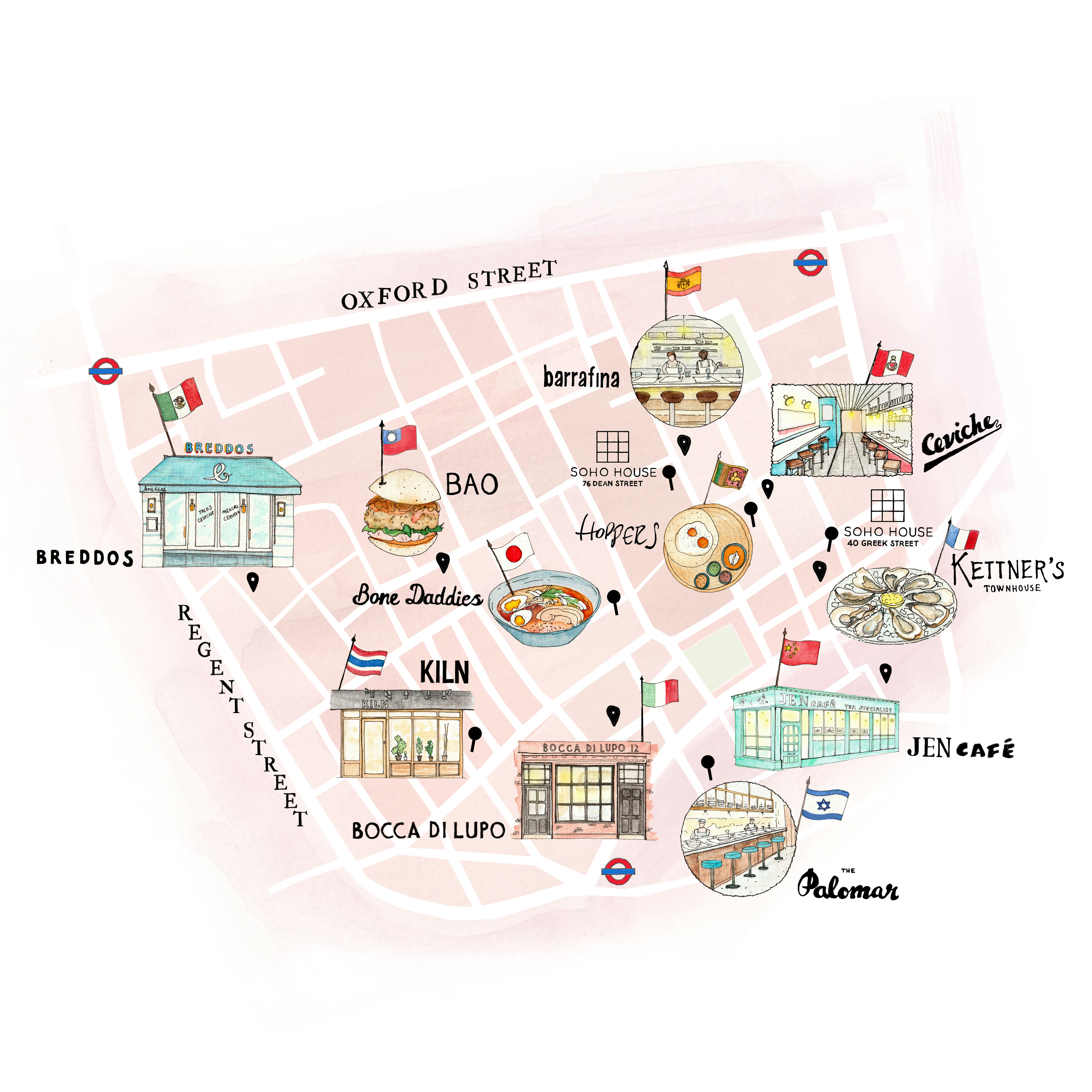 Katherine KannonIllustrated map of Soho for Soho HouseI created this illustrated map of restaurants in Soho for Soho House, which was featured in their magazine 'House Notes'. View Folio
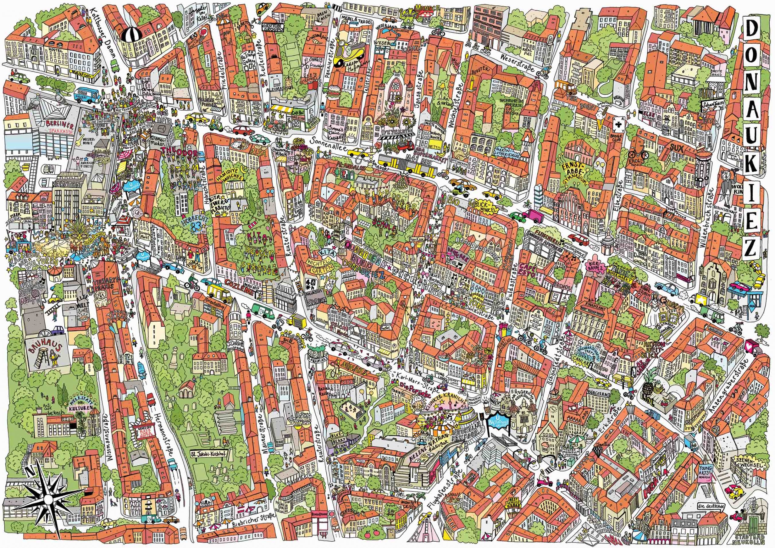 Katherine KannonNeighbourhood map for Quartiersmanagement Donaustrasse-Nord View Folio
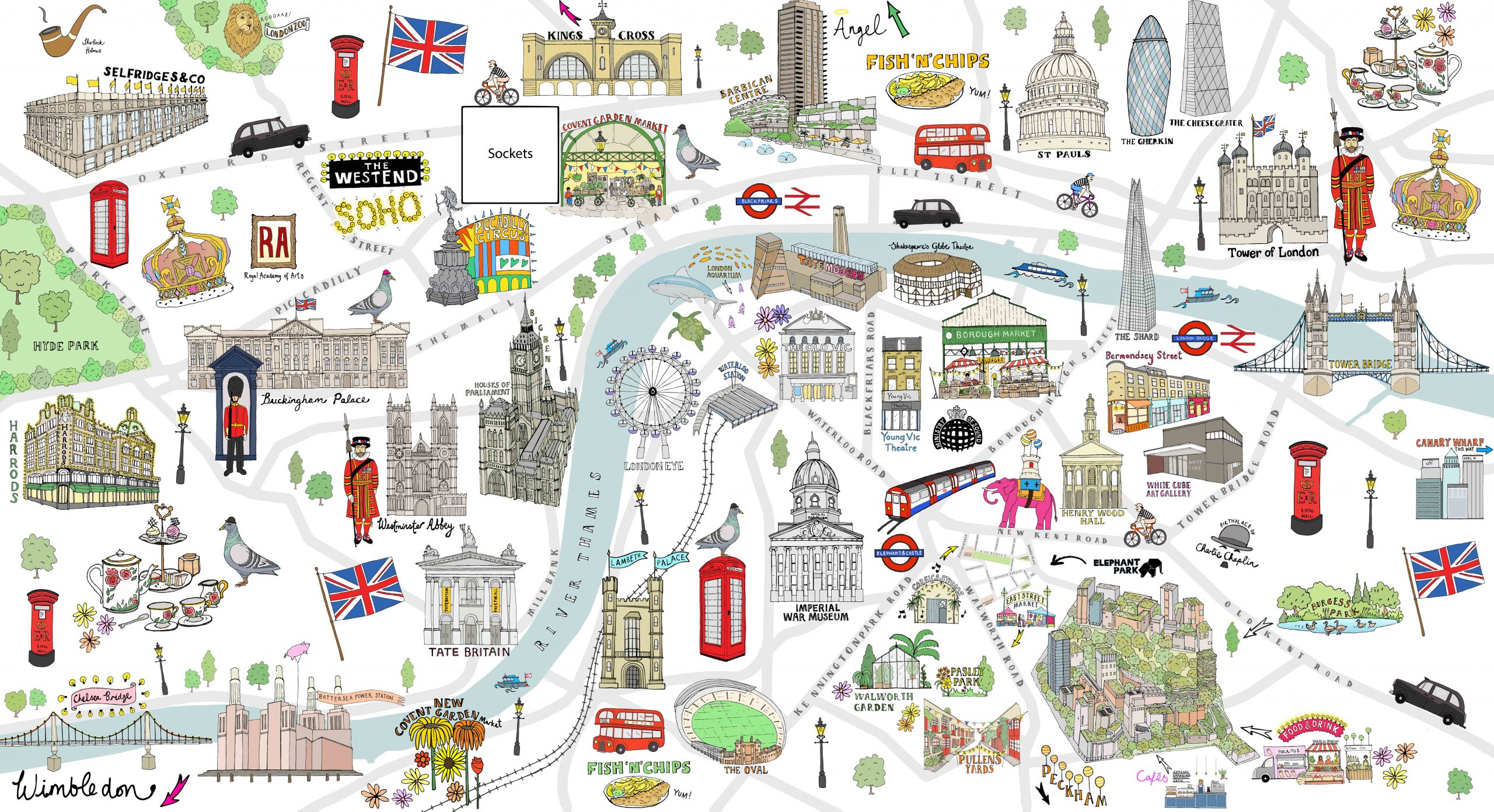 Katherine KannonLondon Map mural for Lendlease#s headquarters at Elephant Park View Folio
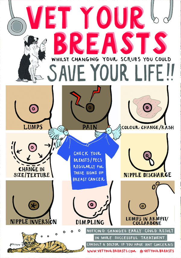 Katherine KannonVet Your Breasts breast cancer awareness poster View Folio
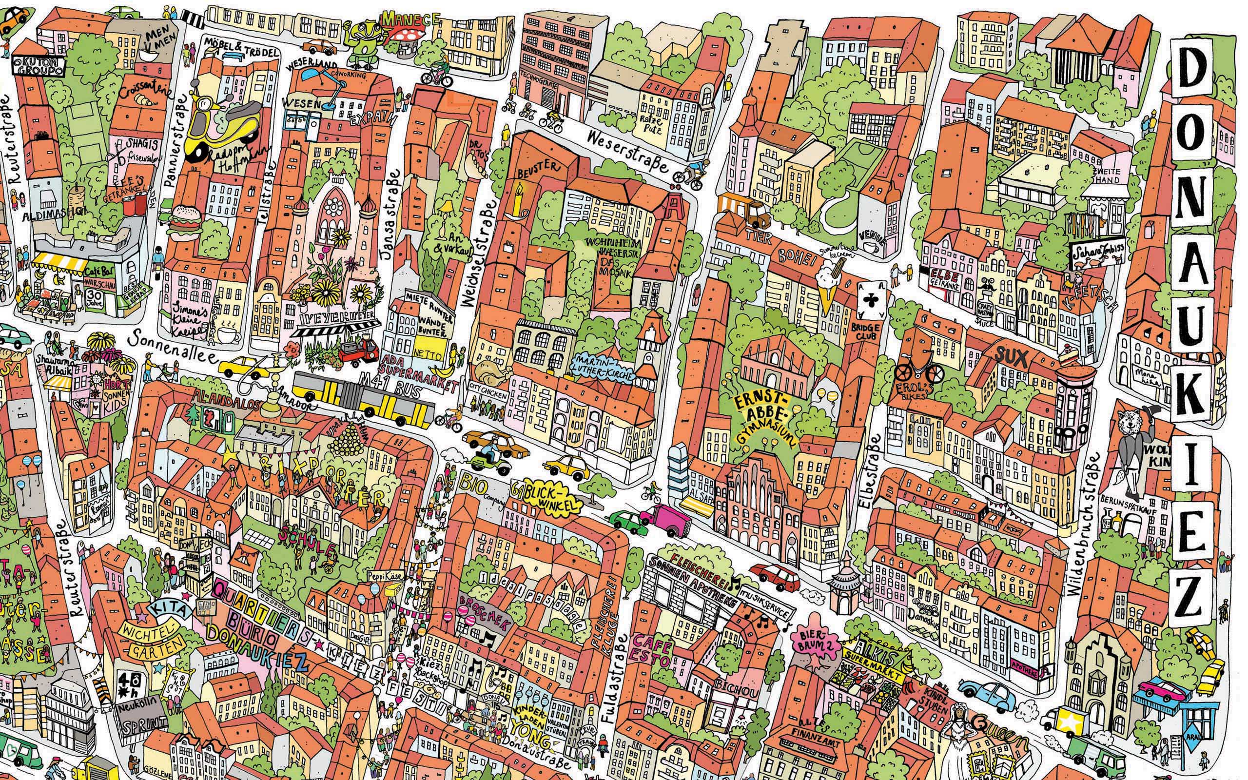 Katherine KannonNeighbourhood map for Quartiersmanagement Donaustrasse-Nord, Berlin View Folio
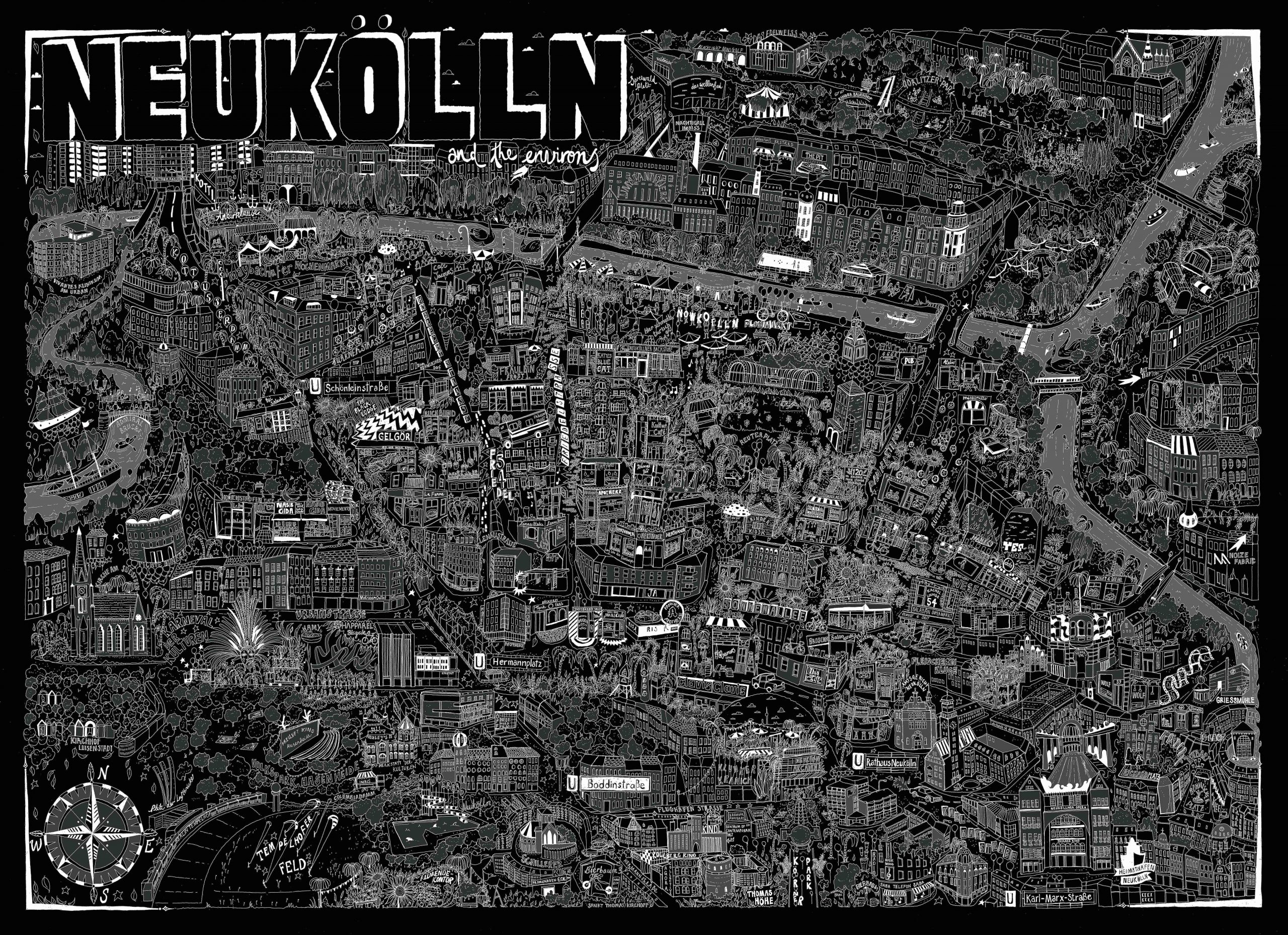 Katherine KannonIllustrated map of Neukölln, BerlinThis map was a personal project. When I first moved to Berlin I lived in many different flatshares in the district if Neukölln, and this map features a lot of my memories from my time there. View Folio
 Katherine KannonCompany greetings card for Undercover Architecture View Folio
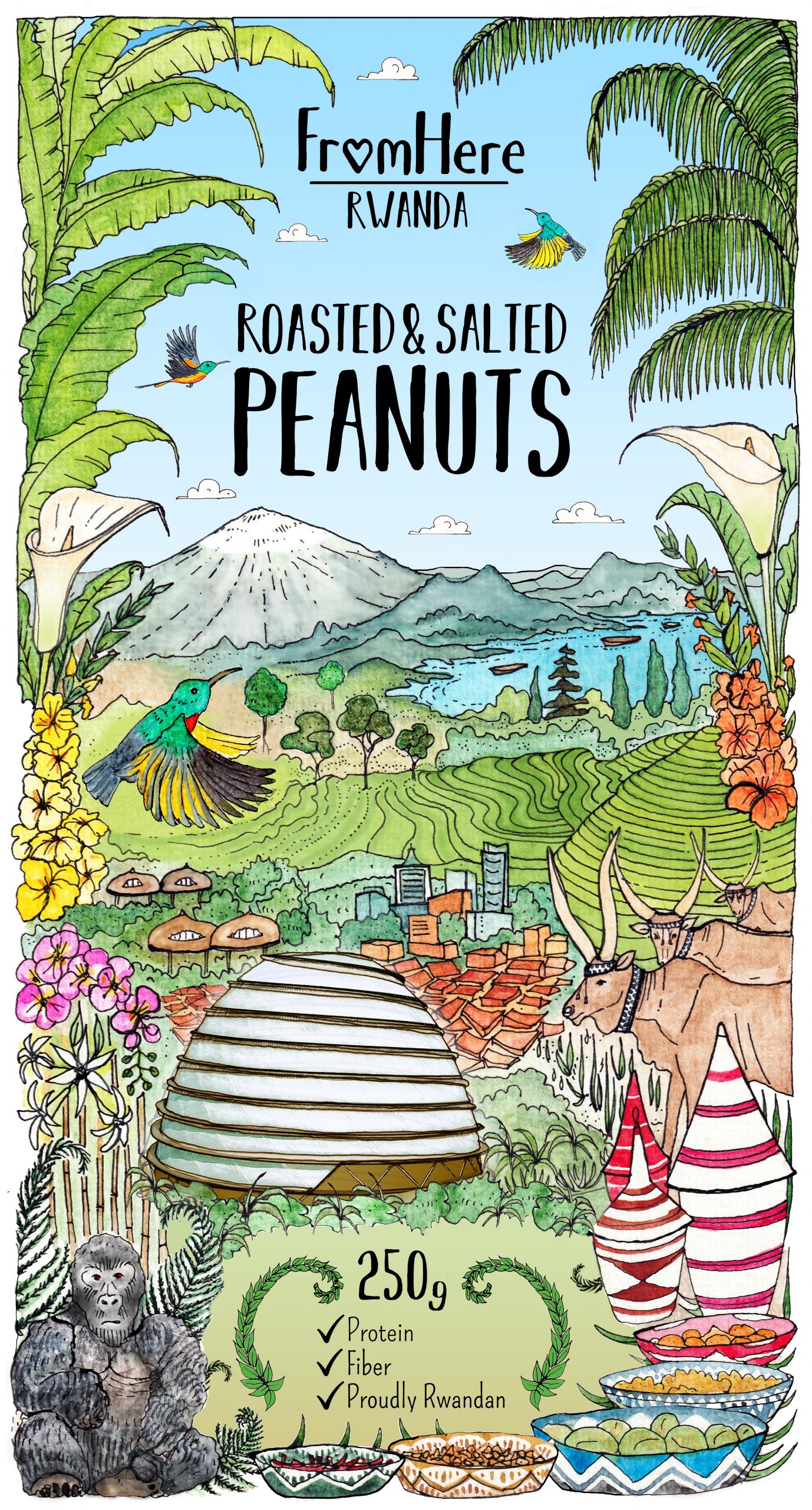 Katherine KannonFood Packaging label design for Endeva View Folio
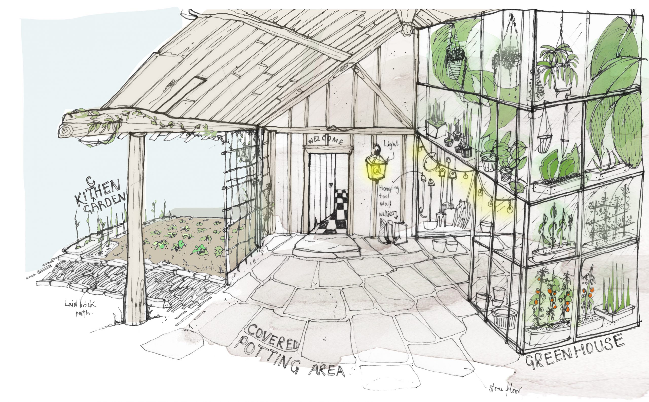 Katherine KannonTyte Tap-Sketch of covered potting area View Folio
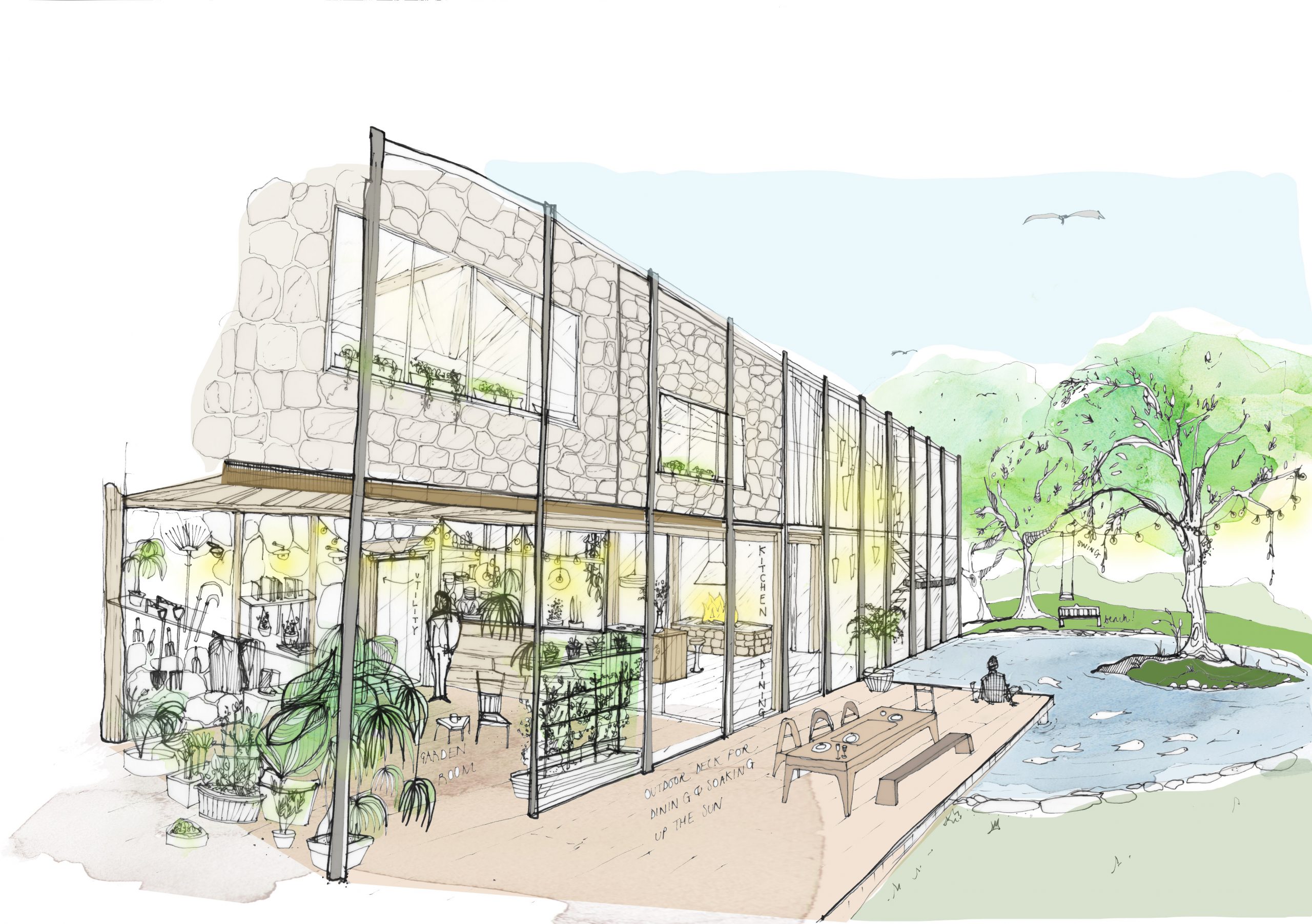 Katherine KannonTyte Tap- Exterior sketch View Folio
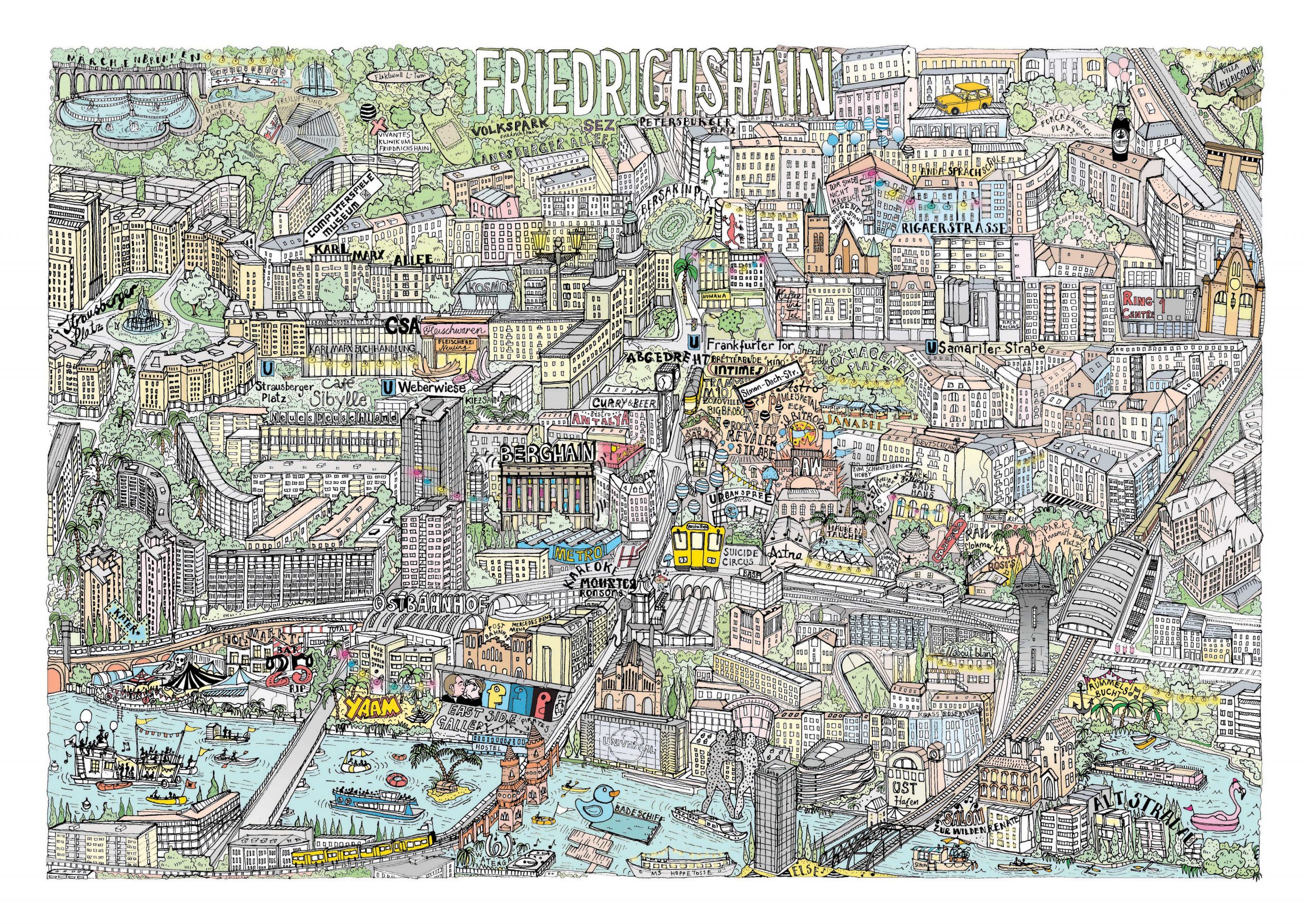 Katherine KannonPersonal project – Illustrated map of Friedrichshain, Berlin View Folio
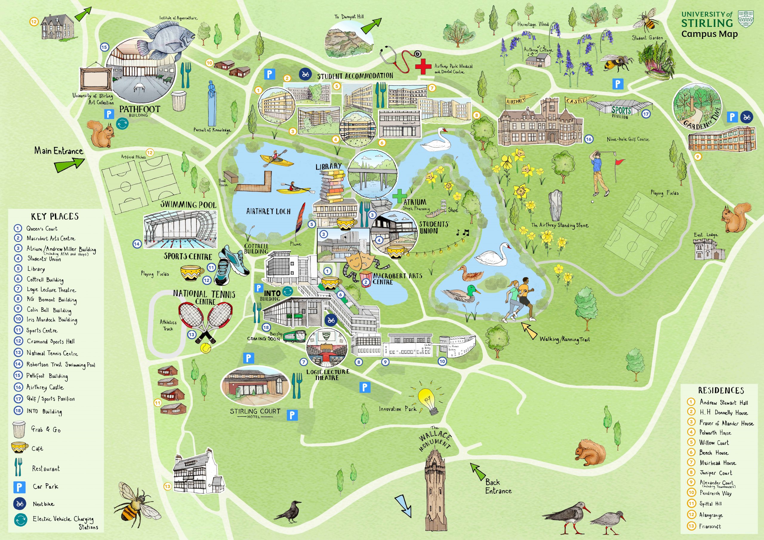 Katherine KannonIllustrated campus map of the University of StirlingI was commissioned by the University of Stirling, Scotland to design an alternative, fun version of their campus map. The map was given out to new students on arrival at the university as part of their 'Fresher's Pack' as a means to help them navigate their new home.
The brief for the Stirling illustrated campus map specified that the it needed to be informative and readable as a map, whilst giving a fun visual impression of the facilities to be found on site. The map had to depict all of the department buildings and halls of residence as well as highlighting items that wouldn't normally be shown on a map, such as students kayaking in the Loch, squirrels collecting acorns around campus and the view to Dunyat Hill. View Folio
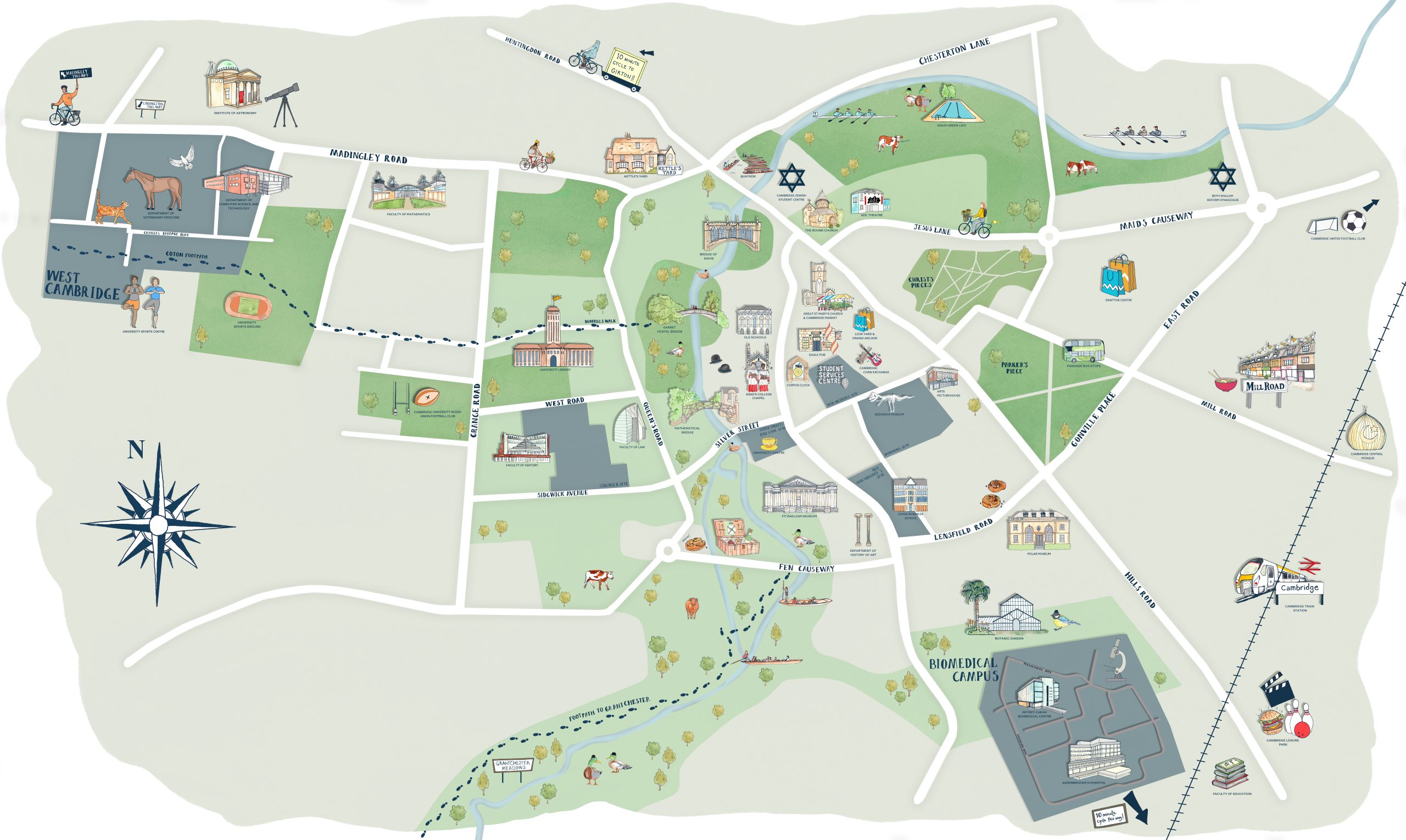 Katherine KannonCampus map for the University of CambridgeI was approached by the University of Cambridge and asked to create an illustrated campus map of the university and surrounding city, to be used as the main display and navigation for a ‘virtual open day’ platform on their website. This platform will be used by prospective students and should give them a visual sense of how the university colleges and buildings sit within the city of Cambridge and the surrounding area View Folio
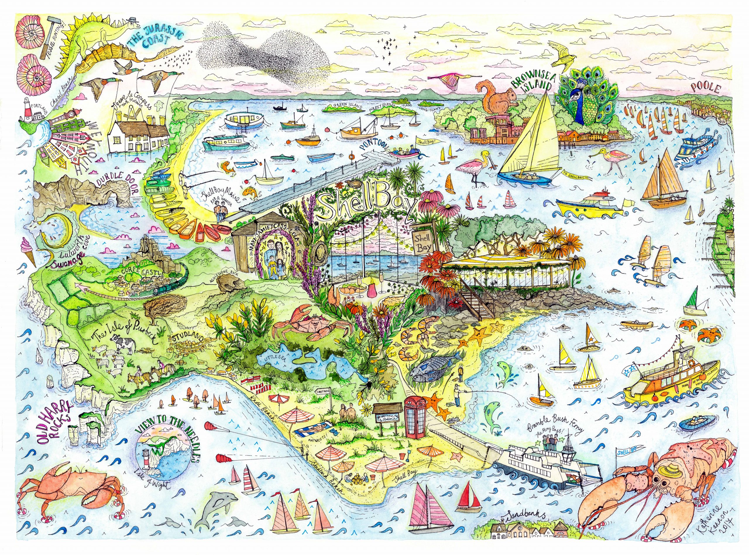 Katherine KannonIllustrated map of Shell Bay restaurantThis map was a commission for the award winning seafood restaurant Shell Bay in Dorset. View Folio
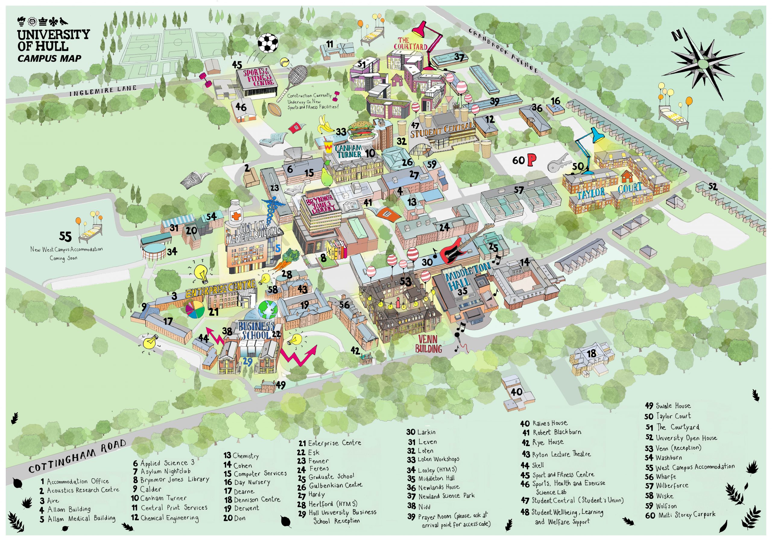 Katherine KannonIllustrated Campus Map of the University of Hull View Folio
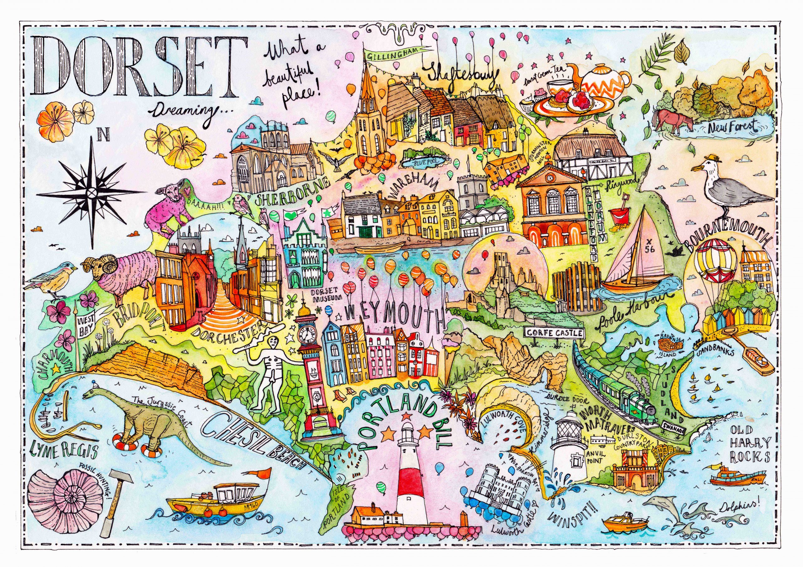 Katherine KannonDorset illustrated map View Folio
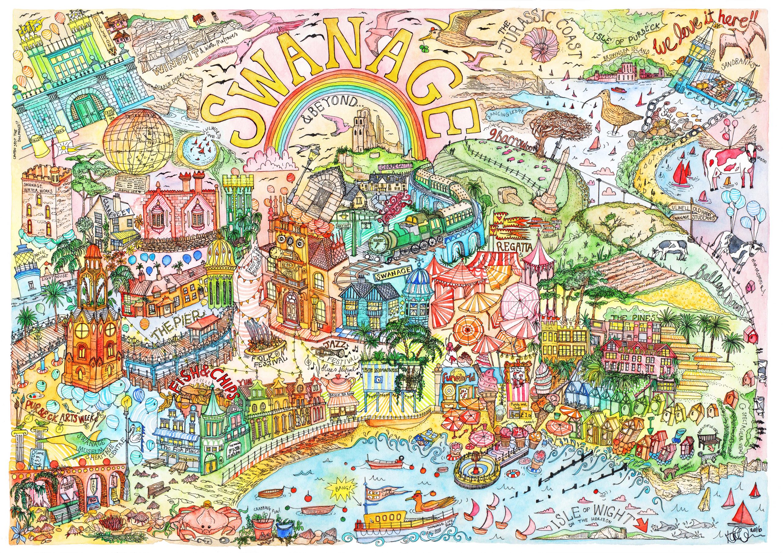 Katherine KannonIllustrated map of SwanageThis was a personal project of the seaside town that my family live in. View Folio
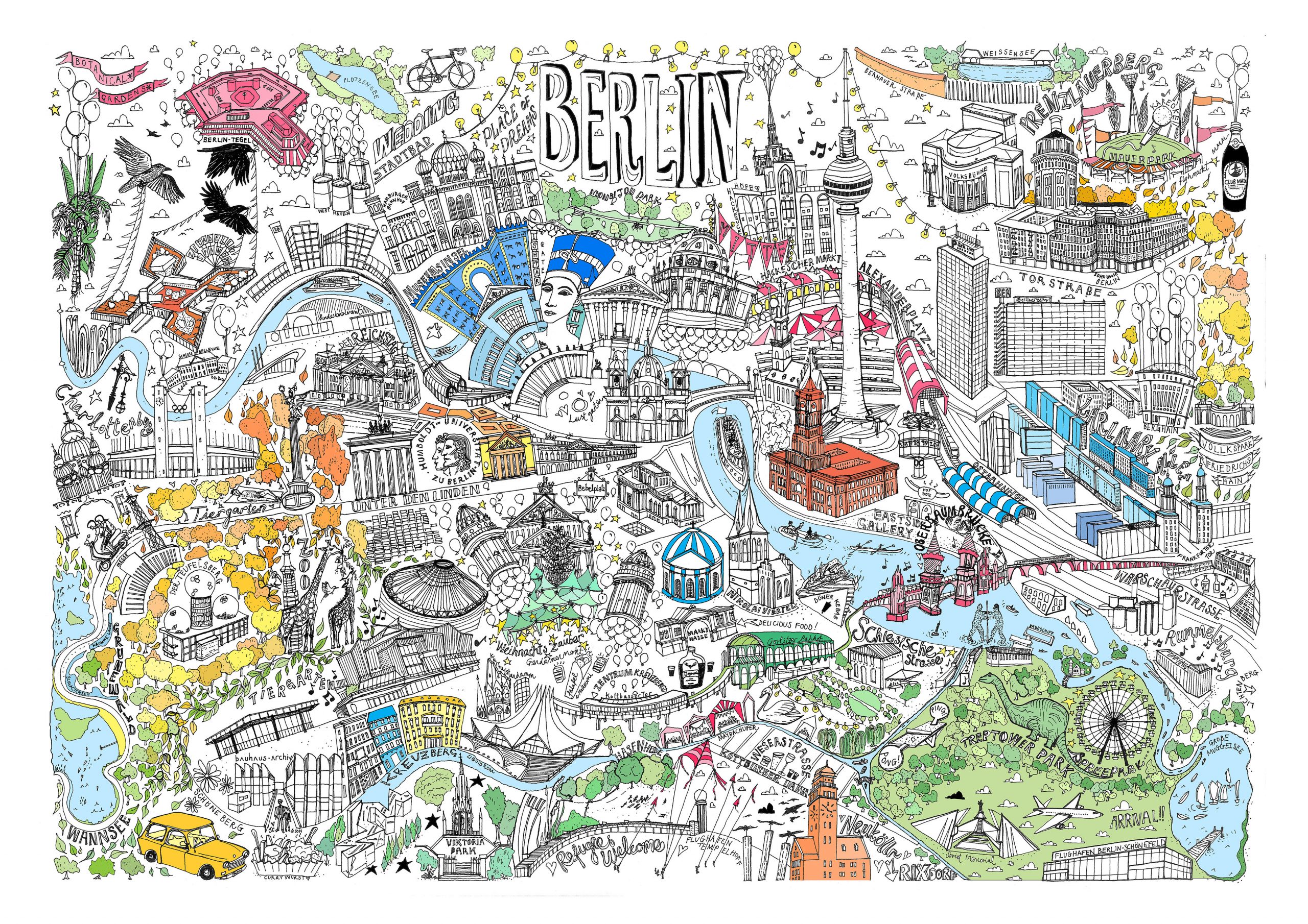 Katherine KannonBERLIN View Folio